Tuesday, December 13, 2011

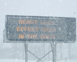
America's snowiest cities...

          If you feel like you have that one story about a crazy snowfall that will trump everyone else's story than you are probably right....if you live in the Northeast.  The Northeastern United States has 4 of the top 7 snowiest major cities.  From Nor'easters, to arctic clippers, to lake effect snow, the Northeast gets it all (in terms of major cities)!  So if you're a snow lover you will have to plan a trip up this way.  
          Of all the cities and towns in the United States the regions that tend to have the most snowfall every year are areas along the heaviest lake effect snow belts (Michigan's upper peninsula and the Tug Hill Plateau region of New York), areas in the foothills of the Rockies and Sierra Nevada's, and lastly area in the valleys and mountains of Alaska.  It seems obvious these are the places that would be getting the most snow as they have a continues moisture source (Great Lakes) and they are in the perfect locations for providing the lift for snowfall to occur (foothills). The snowiest town in all of the U.S. is believed to be Valdez, Alaska with an average of 326.3" of snow EVERY YEAR!  That is about 27 feet of snow!!! If you are not a fan of snow you will certainly need to stay away from there and I'm sure their only mode for transportation is sled or snowmobile.  So as someone who is used to getting up to 3 feet of snow in a day in Upstate NY where I'm from, I can't even imagine this much snow! For all you weather weenies who ask why Valdez gets so much snow when it's in a valley and on the Pacific Coast, 2 words.....Aleutian Low.  So when any of you New Englanders decide you want to complain about your little baby Nor'easters, think twice, you could be living in Valdez, AK.  


Freezing rain in the forecast??

Right now we are forecasted to get some mixed frozen precipitation, including some freezing rain.  The reason why this could be a concern is that freezing rain can cause a lot of damage depending on how much we get.  The pattern has been that we have been getting a lot more warm air advection and therefore much more rain still reaching up to New England, with the exception of the October/Halloween and November/Thanksgiving snowstorms.  Will this be the case again?  Well, typically in a freezing rain setting for areas in the Northeast we will see a low pressure system over the Great Lakes with a warm front or quasi-stationary front set up across upstate New York (with the freezing rain falling to the north of the surface front) and high pressure centered over Nova Scotia/the Canadian Maritimes.  Currently this is just about the exact setting we will be seeing Wednesday night into Thursday.  But something important to note when forecasting freezing precipitation is that most times it is the local features that have the biggest influence on freezing rain.  It is extremely important to have a well established cold pool at the surface where the falling rain drops can refreeze when they hit the ground.  This is what we will be watching at Wednesday night approaches. Stay tuned for an updated forecast...

The Soaker that was 2011

From severe thunderstorms, to frontal boundaries, to hurricanes, to snow storms, this year has proven to be one of the wettest on record for many, especially those of us here in the Northeast.  New York, Connecticut, Massachusetts, and Vermont have all set a new record with 2011, from records dating back from 1895.  Several places stretching from the Ohio River Valley to northern New England have had precipitation amounts 20 inches more than the normal!!  This is quite the figure and it will be interesting to see how the year will finish off.  It hasn't been much of a Winter so far with many places seeing much milder temperatures and there is no major storm in the forecast yet.  But that's the best thing about weather, it's always changing!

For more information on the record setting year for precipitation go to: http://www.weather.com/outlook/weather-news/news/articles/record-wet-year-east_2011-12-10


Sunday, December 11, 2011

A glimpse into broadcast meteorology...

         After I graduate college in May I plan on look for a job as a TV weatherperson.  In the meteorology world it may not be the most looked to profession but I like it because it gives us a chance as scientists to explain something complex to the general public.  As a TV weatherperson you also get a sense of community involvement and most of all you get to share your love for the weather with the viewers.  In the summer I was able to intern at a CBS affiliate in Rochester, NY.   At this station I learned all the inter-workings of how a weather broadcast gets made.  I was also able to get practice in front of the green screen and work on graphics and monitor severe weather.  I also got involved in the community involvement aspect of the profession where I attended a few Backyard BBQs where the Chief Meteorologist would do a live broadcast from a viewer's backyard and mingle with them and answer any questions they had.  It was a great way to teach more about meteorology and gain the respect of the public while gaining viewership.
        This past semester I took part in a broadcasting class at my school, Plymouth State University, where every Monday (and occasionally Fridays) I created and taped my own weather broadcast to be seen on a public television station.  My broadcasts can be seen at this website vortex.plymouth.edu/tv/files as the files saved as Norris(month & date). m2p.mpeg.  I've learned that the most important thing about broadcasting is to be able to show your personality while still coming across as someone with plenty of knowledge and experience and who can be trusted.   It has been a ton of fun and I know I still have plenty of work to do but I am very excited for the career I have ahead of me!

Geminid Meteor Shower Forecast...


Our next visible meteor shower is the Geminid meteor shower on this Tuesday night and Wednesday night (Dec. 13th and 14th).  The best night for viewing here in the Northeast is Tuesday, December 13th.  Unfortunately the forecast for this Tuesday night is partly to mostly cloudy so it may not allow for the best viewing conditions.  Another factor which may hinder the viewing conditions is that our moon phase will be in the waning gibbous phase after we had a full moon on Saturday.  Therefore it will make the sky very bright and some of the meteors may be less visible to the naked eye.  On a good night the Geminid meteor shower can show up to 50 meteors per hour (that's almost 1 meteor per minute).  So even if you won't be able to see as many meteors you should still be able to see some so take some time to bundle up and head out to place without much light to get a  glimpse of some meteors!

For more information on the Geminid meteor shower visit:

http://earthsky.org/astronomy-essentials/earthskys-meteor-shower-guide

Lunar Eclipse

Some of you may not know, but early Saturday morning there was a lunar eclipse.  This eclipse will be the last lunar eclipse we will be able to see for 3 years.  The eclipse was not too visible here in the eastern United States (because of the location and cloudy skies), but it was much more visible on the West Coast.  A lunar eclipse occurs when the moon passes directly behind the earth.  When this happens, the sun's rays are blocked by the Earth from reaching the moon therefore casting a shadow on the moon.
A video of the lunar eclipse viewed around the world:
http://www.weather.com/weather/videos/news-41/space-449/eclipse-views-from-around-the-world-22896
Another video of the full lunar eclipse:
http://www.weather.com/weather/videos/news-41/space-449/eclipse-views-from-around-the-world-22896#loc=62/436/22895
videos provided by www.weather.com

Thursday, December 8, 2011

Lake effect snow on its way!

As westerly flow has been set up across the region of Upstate/Western New York it will bring about another chance for some lake effect snow.  This westerly flow has been set up after a cold front passed through the region earlier this week.  This same cold front has brought some cold arctic air across the region as well, another very important ingredient for lake effect snow.  For areas north of Buffalo this will be the first significant lake effect they have seen.  The snow will begin later tonight and last though much of the day tomorrow, although it will be much lighter by tomorrow evening.  There is plenty of moisture moving into the region ahead of a low pressure system that will be moving in, in a few days.
So how much snow will most of us get?  This is not a very significant event so most areas will get 1-4" with other localized areas receiving 6-12".  The areas receiving more snow will be the ones set up under the heavier lake effect bands.
Here's an image of expected amounts of snow:


This image was made by Scott Hetsko and taken from WROC's webpage in Rochester, NY. (where I interned over the summer)