Tuesday, December 13, 2011

America's snowiest cities...

          If you feel like you have that one story about a crazy snowfall that will trump everyone else's story than you are probably right....if you live in the Northeast.  The Northeastern United States has 4 of the top 7 snowiest major cities.  From Nor'easters, to arctic clippers, to lake effect snow, the Northeast gets it all (in terms of major cities)!  So if you're a snow lover you will have to plan a trip up this way.  
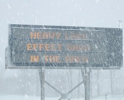
          Of all the cities and towns in the United States the regions that tend to have the most snowfall every year are areas along the heaviest lake effect snow belts (Michigan's upper peninsula and the Tug Hill Plateau region of New York), areas in the foothills of the Rockies and Sierra Nevada's, and lastly area in the valleys and mountains of Alaska.  It seems obvious these are the places that would be getting the most snow as they have a continues moisture source (Great Lakes) and they are in the perfect locations for providing the lift for snowfall to occur (foothills). The snowiest town in all of the U.S. is believed to be Valdez, Alaska with an average of 326.3" of snow EVERY YEAR!  That is about 27 feet of snow!!! If you are not a fan of snow you will certainly need to stay away from there and I'm sure their only mode for transportation is sled or snowmobile.  So as someone who is used to getting up to 3 feet of snow in a day in Upstate NY where I'm from, I can't even imagine this much snow! For all you weather weenies who ask why Valdez gets so much snow when it's in a valley and on the Pacific Coast, 2 words.....Aleutian Low.  So when any of you New Englanders decide you want to complain about your little baby Nor'easters, think twice, you could be living in Valdez, AK.  


Freezing rain in the forecast??

Right now we are forecasted to get some mixed frozen precipitation, including some freezing rain.  The reason why this could be a concern is that freezing rain can cause a lot of damage depending on how much we get.  The pattern has been that we have been getting a lot more warm air advection and therefore much more rain still reaching up to New England, with the exception of the October/Halloween and November/Thanksgiving snowstorms.  Will this be the case again?  Well, typically in a freezing rain setting for areas in the Northeast we will see a low pressure system over the Great Lakes with a warm front or quasi-stationary front set up across upstate New York (with the freezing rain falling to the north of the surface front) and high pressure centered over Nova Scotia/the Canadian Maritimes.  Currently this is just about the exact setting we will be seeing Wednesday night into Thursday.  But something important to note when forecasting freezing precipitation is that most times it is the local features that have the biggest influence on freezing rain.  It is extremely important to have a well established cold pool at the surface where the falling rain drops can refreeze when they hit the ground.  This is what we will be watching at Wednesday night approaches. Stay tuned for an updated forecast...

The Soaker that was 2011

From severe thunderstorms, to frontal boundaries, to hurricanes, to snow storms, this year has proven to be one of the wettest on record for many, especially those of us here in the Northeast.  New York, Connecticut, Massachusetts, and Vermont have all set a new record with 2011, from records dating back from 1895.  Several places stretching from the Ohio River Valley to northern New England have had precipitation amounts 20 inches more than the normal!!  This is quite the figure and it will be interesting to see how the year will finish off.  It hasn't been much of a Winter so far with many places seeing much milder temperatures and there is no major storm in the forecast yet.  But that's the best thing about weather, it's always changing!

For more information on the record setting year for precipitation go to: http://www.weather.com/outlook/weather-news/news/articles/record-wet-year-east_2011-12-10


Sunday, December 11, 2011

A glimpse into broadcast meteorology...

         After I graduate college in May I plan on look for a job as a TV weatherperson.  In the meteorology world it may not be the most looked to profession but I like it because it gives us a chance as scientists to explain something complex to the general public.  As a TV weatherperson you also get a sense of community involvement and most of all you get to share your love for the weather with the viewers.  In the summer I was able to intern at a CBS affiliate in Rochester, NY.   At this station I learned all the inter-workings of how a weather broadcast gets made.  I was also able to get practice in front of the green screen and work on graphics and monitor severe weather.  I also got involved in the community involvement aspect of the profession where I attended a few Backyard BBQs where the Chief Meteorologist would do a live broadcast from a viewer's backyard and mingle with them and answer any questions they had.  It was a great way to teach more about meteorology and gain the respect of the public while gaining viewership.
        This past semester I took part in a broadcasting class at my school, Plymouth State University, where every Monday (and occasionally Fridays) I created and taped my own weather broadcast to be seen on a public television station.  My broadcasts can be seen at this website vortex.plymouth.edu/tv/files as the files saved as Norris(month & date). m2p.mpeg.  I've learned that the most important thing about broadcasting is to be able to show your personality while still coming across as someone with plenty of knowledge and experience and who can be trusted.   It has been a ton of fun and I know I still have plenty of work to do but I am very excited for the career I have ahead of me!

Geminid Meteor Shower Forecast...


Our next visible meteor shower is the Geminid meteor shower on this Tuesday night and Wednesday night (Dec. 13th and 14th).  The best night for viewing here in the Northeast is Tuesday, December 13th.  Unfortunately the forecast for this Tuesday night is partly to mostly cloudy so it may not allow for the best viewing conditions.  Another factor which may hinder the viewing conditions is that our moon phase will be in the waning gibbous phase after we had a full moon on Saturday.  Therefore it will make the sky very bright and some of the meteors may be less visible to the naked eye.  On a good night the Geminid meteor shower can show up to 50 meteors per hour (that's almost 1 meteor per minute).  So even if you won't be able to see as many meteors you should still be able to see some so take some time to bundle up and head out to place without much light to get a  glimpse of some meteors!

For more information on the Geminid meteor shower visit:

http://earthsky.org/astronomy-essentials/earthskys-meteor-shower-guide

Lunar Eclipse

Some of you may not know, but early Saturday morning there was a lunar eclipse.  This eclipse will be the last lunar eclipse we will be able to see for 3 years.  The eclipse was not too visible here in the eastern United States (because of the location and cloudy skies), but it was much more visible on the West Coast.  A lunar eclipse occurs when the moon passes directly behind the earth.  When this happens, the sun's rays are blocked by the Earth from reaching the moon therefore casting a shadow on the moon.
A video of the lunar eclipse viewed around the world:
http://www.weather.com/weather/videos/news-41/space-449/eclipse-views-from-around-the-world-22896
Another video of the full lunar eclipse:
http://www.weather.com/weather/videos/news-41/space-449/eclipse-views-from-around-the-world-22896#loc=62/436/22895
videos provided by www.weather.com

Thursday, December 8, 2011

Lake effect snow on its way!

As westerly flow has been set up across the region of Upstate/Western New York it will bring about another chance for some lake effect snow.  This westerly flow has been set up after a cold front passed through the region earlier this week.  This same cold front has brought some cold arctic air across the region as well, another very important ingredient for lake effect snow.  For areas north of Buffalo this will be the first significant lake effect they have seen.  The snow will begin later tonight and last though much of the day tomorrow, although it will be much lighter by tomorrow evening.  There is plenty of moisture moving into the region ahead of a low pressure system that will be moving in, in a few days.
So how much snow will most of us get?  This is not a very significant event so most areas will get 1-4" with other localized areas receiving 6-12".  The areas receiving more snow will be the ones set up under the heavier lake effect bands.
Here's an image of expected amounts of snow:


This image was made by Scott Hetsko and taken from WROC's webpage in Rochester, NY. (where I interned over the summer)

Wednesday, December 7, 2011

Brrrrrrr, it's cold out here!

In the wake of the 2 systems that have passed through the past 48 hours we will be getting some very cold, arctic air filtering down into the region.  This cold air has been positioned over much of the central United States after it moved down from Canada early in the week.  It has brought some very cold single digit highs, highs in the 20s and even Phoenix, AZ experienced a high of 53 on Monday, a temperature very unlikely for this time of year.  These will be the coldest temperatures we've felt in quite some time; with high temperatures only reaching the lower 30s and lows in the teens.  One positive of these colder temperatures is that it will bring some sunshine back for the weekend.  How long will these temperatures last you might be asking?  Temperatures will return to the 40s again early next week and it has also been forecasted that the average December 2011 temperature will be above normal.  One of the reasons for this is the position of the jet stream.  The jet stream has not dug too far south below us yet and it isn't expected to either as there is no blocking system set up and there seems to be no drastic pattern change in sight to bring us significantly colder temperatures.

Here's a really cool image showing the temperature changes in the US over the past 24 hours or so:
US: 24 Hour Temperature Change
Image from: The Weather Channel (www.weather.com)

Snow on the way....

A stalled cold front off the east coast will help to bring some cold temperatures to the region as a rapidly intensifying low pressure system quickly moves through our region tonight and early tomorrow morning.  We will remain rain for the rest of the day but we will change over to snow around 1-2am overnight as some colder air filters in to the region and temperatures begin to fall below freezing.  As the bulk of the system moves through in the early morning hours we could see some heavier snowfall rates (up to an inch an hour).  So exactly how much snow will we expect to get?  Right now I'd say we will end up with an accumulation around 3", even though the snow will be coming down it won't accumulate as much because the ground is so soggy from the rain and relatively warmer temperatures.  After the system moves out tomorrow morning the wind will pick up (could see gusts up to 40mph) and there will be some slick spots on the roads.  The National Weather Service has issued a Winter Weather Advisory in effect from midnight tonight through 8am tomorrow morning. So if you're heading out somewhere late tonight or early tomorrow morning make sure you leave some extra travel time as roads will be slick and slushy and probably a bit icy in higher elevations.
For updated information regarding this storm go to: http://forecast.weather.gov/MapClick.php?CityName=Plymouth&state=NH&site=GYX&textField1=43.7386&textField2=-71.6983&e=0

Friday, December 2, 2011

A Tad Bit on the Warm Side...

     A new statement from the National Weather Service in Buffalo, NY (http://www.erh.noaa.gov/buf/) states that this past November has been the 6th warmest on record for both Rochester, NY and Buffalo, NY.  In the month of November Buffalo was found to be 5.8 degrees above the average temperature for the month and Rochester at 5.3 degrees above average (see climate data).  Another interesting finding is that Buffalo almost tied the record for the latest date of measurable snow, December 3rd.  This record is a record set way back in 1899.  Buffalo missed this record today by recording 4" of snow so far today associated with a cold front moving through the region.
     So what exactly does this mean for our snow season this year in Upstate/Western NY?  Well, with the warmer temperatures the Great Lakes will stay warmer but that doesn't necessarily mean a more intense lake effect season as there are many other variables that come into play with lake effect (i.e. presence of very cold air, proper wind direction, lifting mechanisms).  The climatology has shown that even with warmer November temperatures and a late snow, a winter with normal winter temperatures and snowfall amounts has pursued, but there have been a few times where it was below normal for both.  So it will certainly be interesting to see how this winter rounds out!
     The climatology report for Plymouth, NH has states that we have also had above average temperatures at 4.1 degrees above normal.  While we ended the month of November on the warm side, we are starting off December on the cool side.  Although it may seem like a cold start, it is actually right around the normal for this time of year in Plymouth (normal high: 39, normal low: 19).  And today we even have a slight change of snow as a cold front passes through later this afternoon/evening! So it's a pretty good start to December!


Climate Data:
Rochester, NY - http://www.nws.noaa.gov/climate/getclimate.php?wfo=buf
Buffalo, NY - http://www.nws.noaa.gov/climate/getclimate.php?wfo=buf
Plymouth, NH - http://www.nws.noaa.gov/climate/getclimate.php?wfo=gyx

Saturday, November 12, 2011

First Lake Effect Snow of the Season

          This past Thursday was the first event of the Lake Effect Snow season for areas surrounding Lakes Erie & Ontario.  Granted this was not a major event, it was still a recognizable accumulation (1"-5").  There are specific 'ingredients' needed for Lake Effect snow to occur.  The fist 'ingredient' is a very cold air mass passing over warm lake water.  The magic number for Lake Effect snow to occur is 13. There must be a temperature difference (difference of air temperature and lake temperature) of 13 degrees.  The second thing must be a wind direction that crosses a large fetch (wind blows across a great distance over the lake - i.e. for Lake Ontario a westerly flow is best).  This westerly flow can be initiated by a synoptic scale even (i.e. low pressure system).  On Thursday a cold front associated with a low pressure system passed over Lakes Erie and Ontario which set up a westerly flow and brought cold air across each lake.  Above is an image of the system just after it passed over the Great Lakes region.
          As stated before, this event did not bring a significant amount of snow to the area but it is important since is was the first lake snow.  Areas along Lake Ontario did not see as much snow as areas along Lake Erie because their temperatures stayed warmer.  These warmer temperatures brought mostly Lake Effect rain showers to areas along Lake Ontario, along with some mixed precipitation and graupel.  
          Below is a link to a spotter report released by the National Weather Service in Buffalo, NY from the event:
http://www.crh.noaa.gov/product.php?site=buf&product=PNS&issuedby=BUF&format=ci&version=1
     
          The next chance for Lake Effect snow is Wednesday after a system moves through setting up a period of westerly flow and chilly air.  Hopefully it will be an excellent Lake Effect season!

Friday, November 4, 2011

Excellent Weekend in View

A Canadian high pressure background will build into the region later on today and it will continue to dominate our weather pattern for the next several days.  This high pressure will allow us to reach temperatures in the mid 50s! So we go from major snowstorm last weekend back to the 50s and gorgeous Fall sunshine this weekend! This high pressure will be centered over us tonight and into early Sunday when it will move off shore but another high pressure system will move in after.
With this high pressure system we will see sunny sky and much drier air with cool, crisp nights.  This beautiful weather will continue into mid week next week until the next system moves through bringing some rain, so get out and enjoy the weather because winter is right around the corner!

Friday, September 30, 2011

Fall Foliage 101

We all enjoy the beautiful colors of the Fall season, especially up here in New Hampshire, but what is the science behind it? Well, in order for leaves to be bright green they need lots of sunshine and typically milder temperatures.  Chlorophyll is the main chemical in the leaves which gives them their green color.  In the fall the days become shorter so there is less daylight and therefore less sunshine for the chemical process to occur.  It has also been proven that the weather can affect the leaves changing color as climatologically, the fall and winter months are cloudier than the summer months.  Cooler weather affects the leaves in that the cold air closes up the veins in the leaves where the chemical reactions occur, without those reactions the green color fades.  Without the sunshine and long hours of daylight other chemicals take over giving the leaves their yellow, orange, red, and brown colors.  This year's fall foliage should be pretty nice as we have had a favorable summer and a few warm fall days so far (weather like this makes the colors more vibrant).  Of course each type of tree is different, but here in New England where the mountians are covered with many different types of trees the colors appear to be more colorful.  The peak fall foliage viewing times for New Hampshire are early to mid Ocotober.

For more information of how leaves change:
http://na.fs.fed.us/fhp/pubs/leaves/leaves.shtm

To track fall foliage visit:
http://www.wmur.com/ne-fall-colors/index.html

Tuesday, September 13, 2011

Is that snow!???... In September!????

Yes! There is snow being forecasted only a mere couple hundred of miles from the U.S. - Canadian border!  That is proof of how cold this air is that is diving down from Canada.   But don't worry! We won't be seeing any snow here in NH! As this front moves through overnight we will only get some brief showers, some heavy in some areas, and possibly a few thunderstorms. But it will be chilly at night by the end of the week so have that extra blanket handy!

Brrrrrr! I thought Fall began next week!?

      As you all know Autumnal equinox is Friday September 23 this year at 5:05am but in the world of weather weenies the Meteorological Fall began on September 1st.  By the end of this week and into the weekend you will definitely be thinking it is Fall already.   Over the weekend a broad region of high pressure matched with a cold front,  was sitting up in Northwestern Canada.  This cold front will dive down across much of the United States mid-week.  Here in the Northeast the cold front will cross our region sometime Wednesday afternoon into Wednesday evening.  As the front moves through there will be a chance of some rain showers Wednesday afternoon and into Thursday.  There may even be a rumble of thunder or two.  After this front passes through we will find that some areas will be struggling to get out of the 50s on Friday! Even more surprising will be the overnight lows.  Many areas won't even reach 40 at night at the end of the week and some places up North ( i.e. Northern NH, VT, NY, and ME, and North Dakota, Montana, and Northern Minnesota) have a possibility of seeing thier first frost of the year.  I guess this is Mother Nature's way of saying 'get ready!', because Fall is quickly approaching.  Luckily behind the cold front there is a broad region of high pressure which will encompass much of the Eastern United States make for a spectacular weekend!

Wednesday, September 7, 2011

When Bad Weather Strikes it is a Call for Us to Unite and Help

    Over the summer as I sat by a bonfire with my family in my backyard watching the thunderstorm that formed off of a lake breeze off of Lake Erie I remembered both why I love the weather and why I sometimes hate it.  The lightning filling up the sky in the distance with luminous purples and oranges was spectacular and beautiful but it also reminded me of the dangers of weather.  A few weeks ago it was posted all over the web that the country music band Sugarland's stage collapsed at the Indiana State Fair killing 4 and injuring dozens more.  The collapse was likely due to a wind gust upwards of 60mph that came from a strong line of thunderstorms that passed over the area as a cold front moved through.  I can only stress the importance of staying in a safe location when bad weather comes by, and please listen to local meteorologists or other officials and keep your eye to the sky. 
    
     Thunderstorms can develop very quickly and intensify just as fast. One that formed around the same time over Monroe County popped up and only left a few rain drops on the westside, but by the time it reached the city the rain was reportedly coming straight down, or sideways at times with plenty of lightning and even hail.  Many were left without power for several hours and as the storm continued to head out of Monroe County into Wayne County there were reports of hail, fast winds, the sky appeared to be rotating, and many trees and powerlines were down.  Luckily everyone stayed safe here in the Rochester area. 
     While Thunderstorms are the most recognized form of severe weather in the summertime, severe drought is also one of the most frequent this time of year.  The people in the Horn of Africa and its surrounding countries are suffering from one of the worst droughts and famines seen yet.  Typically this region of Africa experiences a wet and dry season.  For this year and most of last year the region has received barely any rain at all and if they have received some it has not been enough to establish crops.  For the rainy season the Inter Tropical Convergence Zone (ITCZ) will move north into the region bringing abundant rain in the months of March to May.  Typically this time of year is when most of the crops are harvested, but this year there are no crops to harvest.  Another cause for why this shift of the ITCZ did not occur was because there is a stong La Nina leaving relatively drier conditions across much of the Horn of Africa. There are many people still without food and donated food supplies are running out. In the end this could prove to show an entire generation may be nearly wiped out.  In a recently published article (http://hosted.ap.org/dynamic/stories/A/AF_EAST_AFRICA_FAMINE?SITE=AP&SECTION=HOME&TEMPLATE=DEFAULT&CTIME=2011-09-05-05-03-40) the U.N. states that nearly 13 million people are still in need of aid.  This is an urgent issue and it will not be going away anytime soon.  Forecasts are showing that the region will not be getting the rain it needs for the harvest it needs. 

         There are many ways to help but first educate yourself and your friends about the issue (http://www.msnbc.msn.com/id/44399980).  Here is a  list of some organizations that are helping:
-UNICEF (Text FOOD to UNICEF (864233) to donate $10)
-International Committee of the Red Cross (http://www.icrc.org/)
-Edesia Global Nutrition Solutions (http://www.edesiaglobal.org/) <-- provides nutritional bars that contain much of the nutrients people are not getting. 
-The World Food Programme (Text the word AID to 27722 to donate $10)
-Doctors Without Borders (http://www.doctorswithoutborders.org/news/allcontent.cfm?id=68)
-Water for Sudan (www.waterforsudan.org) <-building wells in Southern Sudan, changing lives.

Friday, June 10, 2011

Spring makes a return?

     Temperatures for the next few days, with the exception of Saturday, will hang around 70 in Rochester, NY.  This will feel like a fresh breath of air after the past few days hanging near 90 and even surpassing 90 on Wednesday.  With the passage of a cold front Thursday afternoon cooler, more stable air has moved into the area.  The sky will begin to clear overnight and dew points will drop throughout the region allowing for a more comfortable day than what we've seen the past few days.  Also following the passage of the cold front the winds will shift out of the north sending a cool breeze off Lake Ontario which will be one of the additional factors keeping the region's temperatures relatively low.
     Saturday a warm front will move through bringing the region briefly into the 80's and also bringing some scattered showers and thunderstorms through the area.  Some of these storms may have the potential of becoming severe.  If you're planning some activities outdoors this weekend be prepared for a scattered shower or two Saturday and early Sunday.  Keep an eye to the sky! After the warm front moves through temperatures will drop again keeping highs around and below 70 degrees for Sunday and Monday.
     For those of you who enjoy the heat and humidity of the summer you won't have to wait too long until it comes back mid-week next week.  For now enjoy the subtle warmth of Friday and get outside with the family! For those of you weather weenies keep and eye to the sky and to local radar maps for a glimpse of a possible nighttime storm one of the next few nights!

http://forecast.weather.gov/MapClick.php?CityName=Rochester&state=NY&site=BUF&textField1=43.1687&textField2=-77.6158&e=1

Wednesday, March 23, 2011

Spring in the Northeast...get out your shovel!

   It is definitely debatable for whether or not Spring exists in the Northeast, especially after this forecast.  That's right, snow and temperatures in the 30s!! Not very spring-like.
   Wednesday a low pressure system will be moving over the Northeast region.  Currently some snow and mixed precip is moving into southern New York, but it won't be reaching the Rochester area until around 2am.  Current IR satellite images show this system stretching from Montana to Connecticut.  Its currently bringing heavy snow to the Northern Plains region and some severe t-storms and rain to the Midwest.  As this system in the Midwest meets up with another, weaker low pressure system currently in the Virginia/North Carolina region, it will strengthen.  This will occur as the system nears our are and the Great Lakes.
   So what exactly will this mid latitude cyclone be bringing our way? Snow!!! Although majority of the more intense precip will take place south of New York, we will still see a decent amount of snowfall here in Upstate New York.  Both the NAM and the GFS appear to be in pretty good agreement that the Rochester are will see 3-5" of snow with localized areas receiving around 6-8" (i.e. areas closer to the lake).  Areas south of the city could receive some sleet.  This snow will not be the fun fluffy stuff, but rather the ugly, heavy, wet snow.  After this system temperatures will remain in the mid 30s for the res of the week.  Things should hopefully warm up again later next week.
     I will attempt to update this forecast tomorrow! In the mean time get that shovel out again! This is Rochester!

some websites used to make forecast:
http://www.txtornado.net/Compare/_p06_comp_06z.htm
http://www.hpc.ncep.noaa.gov/sfc/namussfcwbg.gif
http://www.rap.ucar.edu/weather/satellite/displaySat.php?region=US&itype=ir&size=large&endDate=20110323&endTime=-1&duration=3
http://forecast.weather.gov/product.php?site=NWS&issuedby=BUF&product=AFD&format=CI&version=1&glossary=1&highlight=off

Friday, February 25, 2011

Just when you thought it was over...

     To all of you who thought that maybe the groundhog got it right and this winter was over....sorry! Mother nature clearly has other ideas.  That quick spring preview last week was nice but unfortunately it was just a cruel joke.  Although for those of you who want to continue skiing or boarding, this is just what the snow doctor prescribed.
     As this system moves its way through New England it will be bring snow, sleet, freezing rain, rain, and high winds.  Here in northern New Hampshire it should stay all snow.  Already we have about 6 inches here in Plymouth and the snow will be intensifying later this afternoon, coming down at more than one inch an hour!
http://www.spc.noaa.gov/products/md/md0142.html <--current mesoscale discussion in regards to heavy precip moving into the Eastern VT to the coast of Maine later this afternoon.  Total snowfall amounts for Plymouth should be around 8-10".
     Back in my hometown of Rochester, NY the system is beginning to move out of the region  leaving behind 7" (10" along Lake Ontario) of fresh heavy, wet snow.  Unfortunately for them, this system moving out will initiate a strong westerly flow as the system moves out over the Atlantic, which will in turn initiate the Lake Effect snow.  Rochester, which already has around 102" on the year should expect another 10"-12" (and possible more along the shore of Lake Ontario) from this storm.  But many in Rochester I'm sure will just say '110"?...that's nothing!'
     Here's a great image I found posted on NOAA's website http://www.nnvl.noaa.gov/imageoftheday.php.  You can see the swath of snow reaching from New York to Maine and the rain and clouds stretching all along the eastern seaboard.  You can also depict the dry slot trying to work its way into Pennsylvania and the Southern Tier in NY.
     Fueling this storm is some intensely warm, moist air coming right off the Gulf of Mexico and some very cold and dry arctic air moving down from central Canada.  As the system moves across the Appalachians it should re-intensify a little while it moves up the coastline from NJ to Maine.  (Surface analysis as of approx. 1pm-http://www.hpc.ncep.noaa.gov/sfc/namussfcwbg.gif).  Tonight will be quite cold after this system moves out of the Northeast around 7-8pm.  Lows across the region will be around 10 above, putting wind chills below zero with winds around 20mph and gusts as high as 40mph.
     Overall this will be a pretty decent storm all around.  A winter storm warning remains in effect until about 5-7pm this evening across the Northeast so if you must drive give yourself plenty of time and be safe!